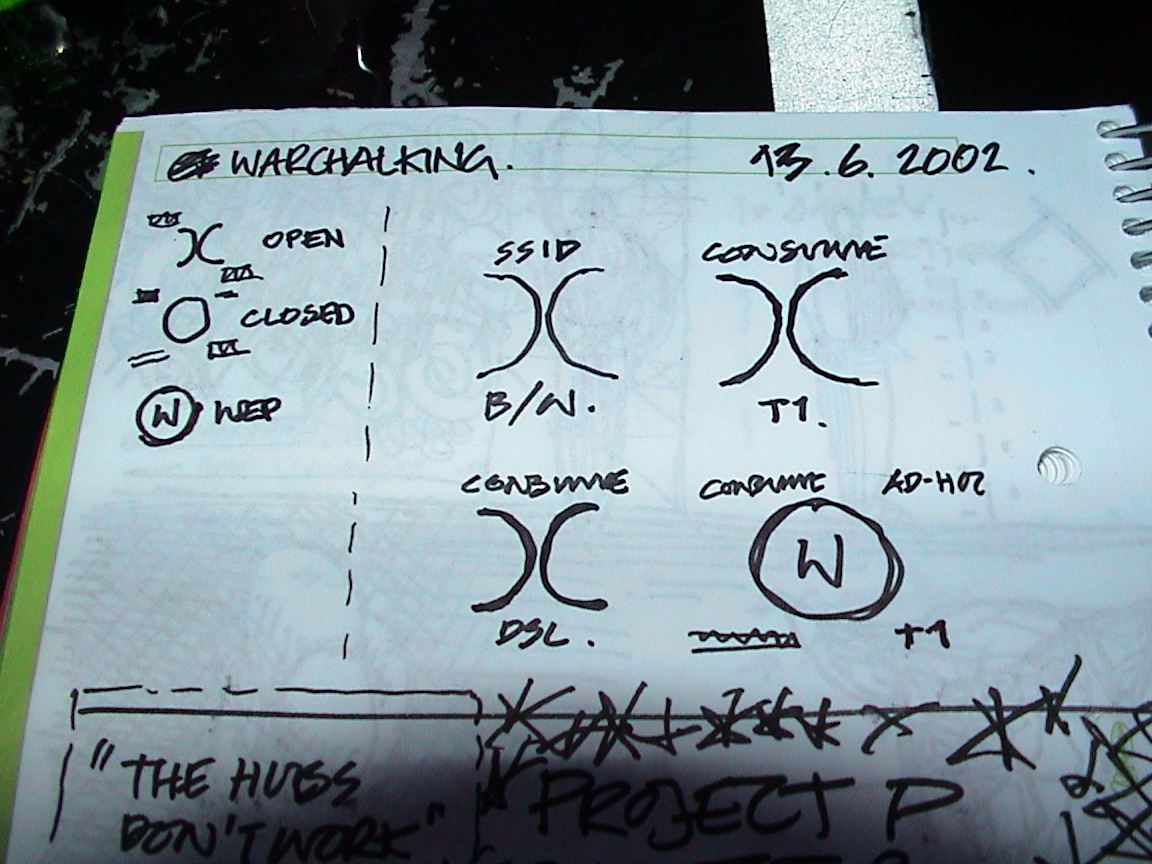
Walking to lunch one day in June 2002, I passed some architecture students chalking up the pavement outside our office. At the table — with Tom Loosemore, Cait Hurley and Danny O’Brien, who’d recently been talking about hobo signs — we landed on an idea: a visual language for marking wireless access points in the city, scrawled in chalk on walls and pavements.
I’d only had a wireless networking card for about two months, and was interested in how it might change a city. The core problem was circular: you had to be online to find the websites that listed free wireless nodes — but what if the information was already out there in the street, waiting for you?
I designed three symbols. An open node: two back-to-back half circles, )(. A closed node: a filled circle. A WEP-encrypted node: a circle with a W inside. You’d chalk the network name above and the bandwidth below. The whole thing fit on a single downloadable PDF.
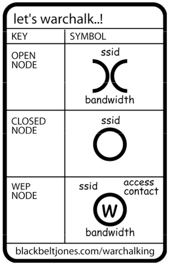
I called it warchalking — a play on “wardriving” (driving around detecting open Wi-Fi), itself from “wardialing” (the old modem-era hacker trick from WarGames). I published the PDF on blackbeltjones.com and wrote about it on Petafloptimism.
The choice of chalk was deliberate. Chalk washes off, so the marks have to be renewed by the people using them. Part of me was a fuddy-duddy who didn’t want to leave permanent marks on the pavement; the more important part liked the idea of the symbols being alive — kept up to date by whoever actually relied on them.
What happened next
Within hours of the blog post it had hit Slashdot, MetaFilter and ZDNet. The first photos of chalk symbols in the wild turned up the same day.
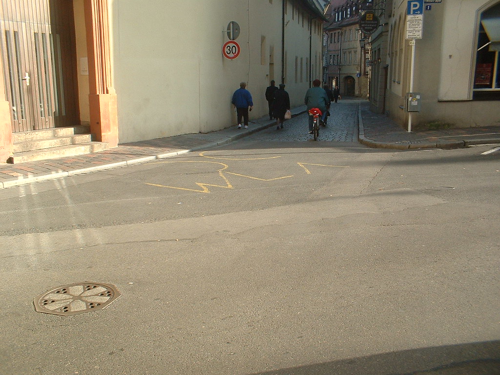
Within days it was running in dozens of publications. Ben Hammersley warchalked the wall outside his own home in Kynance Mews, South Kensington, and wrote it up in The Guardian. (Ben would coin the word “podcasting” a couple of years later.) Cory Doctorow picked it up on Boing Boing. The New York Times ran a feature, and by the end of the year it was in the paper’s annual “Year in Ideas”.

A community site sprang up at warchalking.org, where the FAQ was kept by a then-teenage Aaron Swartz — who called warchalking “merely a new form of being neighbourly”. The state of Utah planned to put the symbols on 250 government buildings. Nokia called it theft, then got caught planting fabricated stories that warchalking was rampant — stories the BBC reported as fact, a small scandal Cory documented on Boing Boing.

The London Wall walk
One of the best afternoons of that summer was a walk along the line of the 2,000-year-old London Wall with Heath Bunting — the net.art pioneer from Bristol — and Kate Rich from Mute magazine. Heath dowsed for water with a twig he’d cut from a hedge on the way; I dowsed for wireless with a TiBook and MacStumbler. We found about 20 nodes along the old route through the City.
Heath asked me whether I recognised that this mapping was “influenced by more ancient networks or nodes — like wells, or meeting places, or routes”. It got at something I hadn’t quite put into words: that the invisible wireless map of the city might sit on top of much older patterns of gathering and trade. The full conversation ran in Mute.
Declaring it dead
By 2003 the wifi cloud had grown big enough that you could just assume a network was there. The problem warchalking solved was dissolving. Invited to speak at the Design Exchange in Toronto — the old Stock Exchange building on Bay Street — I declared warchalking dead.
As the Chalk Magazine retrospective put it in 2025: “The warchalker’s interventions into the civic fabric, like children’s hopscotch patterns, have washed out with the rain.”
The ideas it opened up stayed with me, though — making invisible networks visible, designing at the scale of the pavement, sharing by default. A one-page PDF of three symbols, drawn over lunch, that went round the world in a week. No app, no platform, just chalk.